
The Florida Keys From Start to Finish: A Mile-Marker Guide
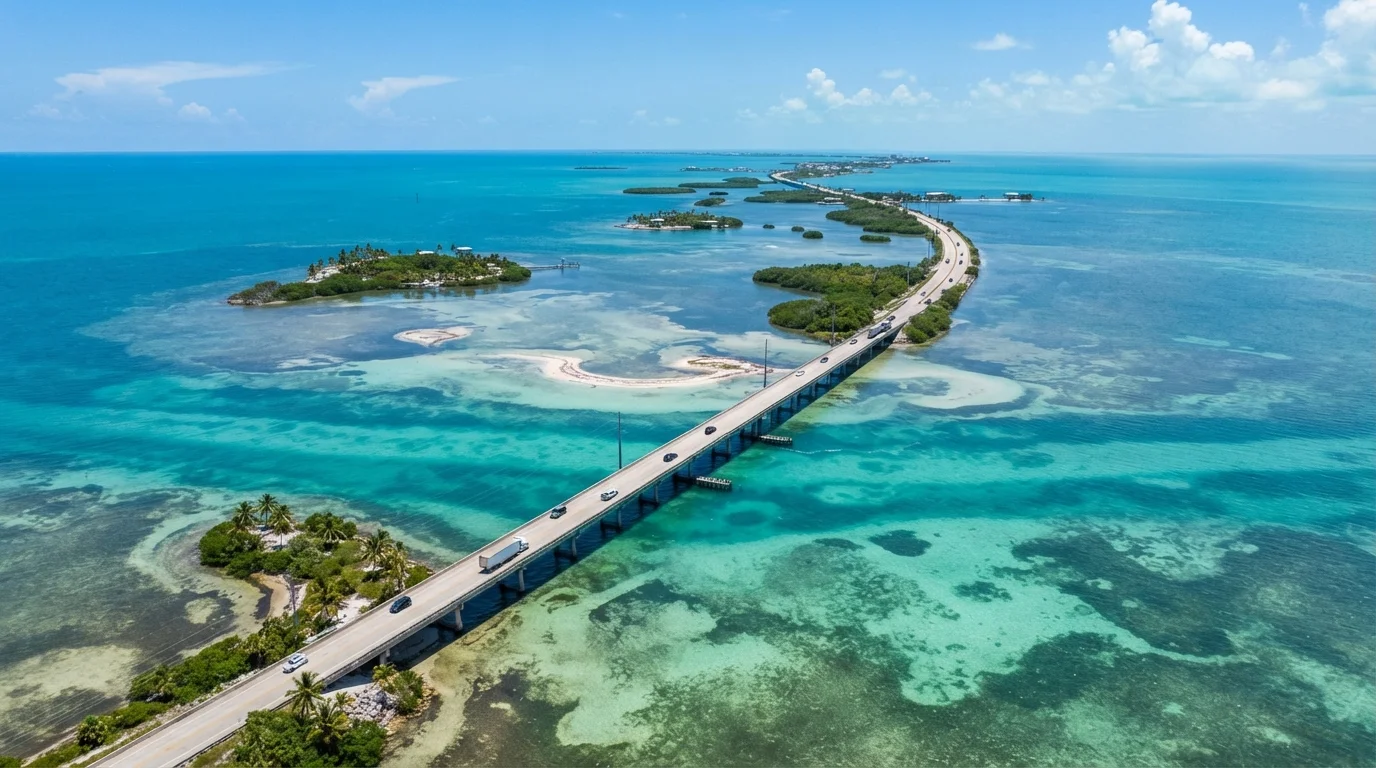
Photo credit: TrendingFaqs.com
In this article
Explore the Florida Keys from Key Largo to Key West using the Overseas Highway's mile marker system as your organizing framework.
Key Takeaways
- Mile markers run from MM 127 near Florida City down to MM 0 in Key West, giving you a reliable navigational framework.
- Each island group along the route has a distinct character, from reef diving in Key Largo to fishing in Islamorada.
- The Seven Mile Bridge near Marathon is one of the most recognizable stretches of road in the United States.
- Key West sits at MM 0 and packs history, architecture, and a walkable downtown into a compact island.
- Verify current entry rules, water conditions, and facility hours with official sources before you travel.
How the mile marker system works
The Overseas Highway, officially US Route 1, runs 113 miles through the Florida Keys and uses green roadside signs called mile markers (MM) to track your position. The numbering starts at MM 127 near Florida City on the mainland and counts down to MM 0 at the corner of Fleming and Whitehead streets in Key West. When locals give directions they almost always use these markers, so learning the system before you go makes navigation straightforward.
Each sign carries a two-sided designation: Oceanside (OS) faces the Atlantic and Bayside (BS) faces Florida Bay. Many addresses in the Keys use this convention directly, so a lodging listed at MM 82 BS is on the Gulf side of the road near that marker. Once you internalize the countdown, the highway becomes a linear itinerary that organizes every stop for you.
Key Largo and the upper Keys (MM 107 to MM 73)
Key Largo is the first and longest island in the chain. It anchors the upper Keys and draws visitors primarily for one reason: coral reefs. John Pennekamp Coral Reef State Park, at MM 102.5 OS, was the first underwater state park in the United States. Its shallow patch reefs and sea grass beds are accessible to snorkelers, while the deeper outer reef line suits scuba divers. Glass-bottom boat tours run from the park for those who want to stay dry.
Tavernier Creek, around MM 90, marks the transition into quieter residential stretches. Indian Key Historic State Park and Lignumvitae Key Botanical State Park sit off the water here and are reachable only by boat; both reward visitors who want context beyond beach time. Lignumvitae preserves one of the last intact tropical hardwood hammock forests in the Keys.
Download offline maps for the Keys before you leave, because cell service goes spotty south of Marathon, particularly on the smaller residential islands.
Coverage gaps are common on the lower Keys, and having offline navigation prevents missed turns on an unfamiliar single-road system.
Book Dry Tortugas ferry tickets as early as possible, ideally months ahead during winter. The daily passenger capacity is strictly capped, and the ferry fills quickly from January through April.
The Dry Tortugas ferry operates with limited seats, and last-minute availability is rare during the peak winter travel season in South Florida.
The upper Keys are also the closest section of the chain to Miami, which means weekend traffic on US-1 can back up significantly. A Friday afternoon departure from South Florida will likely push you into stop-and-go conditions between Homestead and MM 100.
Islamorada and the middle Keys (MM 73 to MM 47)
Islamorada is actually a collection of several islands, including Plantation Key, Windley Key, Upper Matecumbe Key, Lower Matecumbe Key, and a few smaller ones. The area's identity is built around sport fishing. The nearshore flats hold bonefish, tarpon, and permit, making Islamorada one of the better-known flats fishing destinations in the country.
Theater of the Sea at MM 84.7 is a marine animal facility that has been operating since 1946. Anne's Beach at MM 73.5 OS is a shallow, calm swimming spot popular with families. The Florida Keys History and Discovery Center in Islamorada provides background on the 1935 Labor Day Hurricane that destroyed the original Flagler Railroad infrastructure along this section of the Keys.
Windley Key Fossil Reef Geological State Park at MM 85.5 lets you walk through quarry walls cut from the limestone that forms the islands. The exposed cross-sections show coral skeletons preserved in rock, a concrete illustration of how the Keys formed.
Marathon and the lower middle Keys (MM 47 to MM 20)
Marathon sits at the geographic center of the Keys and has the feel of a working town. It has a commercial airport, grocery stores, and fuel stations that serve both visitors and residents of the surrounding smaller islands. Crane Point Museum and Nature Center at MM 50 BS covers Keys ecology and archaeology across 63 acres of tropical hardwood hammock.
The Seven Mile Bridge begins just past MM 47 and carries US-1 across open water to Bahia Honda Key. The current bridge was completed in 1982; the original Flagler-era railroad bridge runs parallel and is partially accessible as a fishing pier. The bridge is long enough that it appears to vanish into the horizon on clear days.
Pigeon Key, a small island under the old bridge, operated as a construction camp during the original railroad project. A small ferry from Knight's Key connects to a history museum there. Bahia Honda State Park at MM 37 has a beach on both the Atlantic and Gulf sides and is one of the few spots in the Keys with natural sandy shore rather than imported sand.
Big Pine Key and the lower Keys (MM 20 to MM 5)
Big Pine Key is home to the National Key Deer Refuge, which protects the diminutive Key deer, a subspecies of white-tailed deer that stands roughly 26 to 28 inches at the shoulder. The refuge covers parts of several islands. Speeds on Big Pine Key are strictly enforced because deer frequently cross the road; posted speed limits here are as low as 35 mph during the day and 25 mph at night.
Looe Key, part of the Florida Keys National Marine Sanctuary, is an offshore reef system accessible by boat from Big Pine Key. The reef runs about five miles offshore and includes large coral structures and clear water that visibility-wise rivals sections of the upper Keys. Dive operators based in the area run regular trips there.
Sugarloaf Key and Cudjoe Key are largely residential. Sugarloaf has a small grass airstrip and the remains of a bat tower built in the 1920s, an attempt to control mosquitoes by attracting bats. The bats never stayed.
Key West (MM 0 to MM 4)
Key West sits at the end of the highway and packs a lot into its 4-by-2-mile footprint. Old Town, the historic district, holds the highest concentration of 19th-century wooden structures in Florida. The Hemingway Home and Museum at 907 Whitehead Street is a documented literary site, though visitors should understand it functions as a ticketed museum and may be crowded. The Key West Lighthouse next door gives a view over the low rooftops of Old Town.
Fort Zachary Taylor Historic State Park at the island's southwest tip has a Civil War-era fortress and the most accessible natural beach on the island. The Dry Tortugas, roughly 70 miles west of Key West, are reachable by ferry or seaplane and contain Fort Jefferson, a massive 19th-century fortification surrounded by open water and reef.
Duval Street is the main commercial corridor and gets noisy after dark. The area around the Historic Seaport at the north end of the island is quieter and has working fishing docks alongside restaurants. Mallory Square, near MM 0, holds a nightly sunset celebration that draws street performers and crowds.
Planning your trip along the Overseas Highway
There is one road in and one road out. That single-road reality shapes everything about a Keys trip. Midweek travel is generally smoother than weekends, and the summer rainy season brings afternoon thunderstorms that can slow driving conditions. Hurricane season runs June through November; always check the National Hurricane Center and Monroe County emergency management sources before traveling during that period.
A realistic pacing for covering the whole chain is three to five nights. One night in the upper Keys, one in Islamorada, one in Marathon, and two in Key West gives each area enough time without rushing. Day-trippers from Miami typically go no farther than Islamorada before turning back, so the islands south of Marathon are noticeably less crowded during the week.
Water activities require reservations at most state parks, particularly during winter high season. Bahia Honda, John Pennekamp, and Dry Tortugas all have capacity limits. Check the Florida State Parks reservation system and the Dry Tortugas National Park ferry schedule well in advance. Verify current entry requirements, fees, and hours directly with each park before your trip.

Author
Travel Editorial Team
Travel Editorial Team is the collective byline for our editorial team and contributor network. Articles published under this byline or an editorial pen name are researched, written, and reviewed according to our editorial standards for clarity, consistency, and independence before publication.
View all articles →